3D terrain mapping and modeling using RTK drones and certified software for high-quality results. 3D mapping and modeling of terrain using RTK drones
RGB photogrammetry and LIDAR
We capture accurate data and generate high-resolution 3D models using drones equipped with RGB and LiDAR technology, providing detailed information for planning, design, and project management in various sectors.
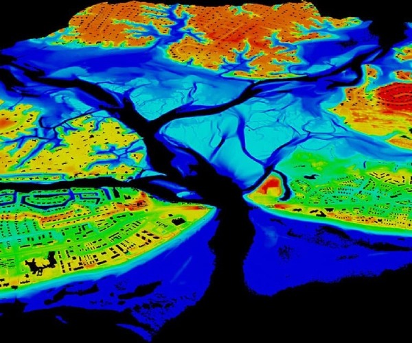
We map watersheds and generate contour lines using drones equipped with high-precision LiDAR and GPS technology, providing essential information for water resource management, flood prevention, and land-use planning.
We calculate the carbon footprint of projects and facilities using data collected by drones and specialized software, enabling our clients to identify opportunities to reduce their environmental impact and meet sustainability goals.
Carbon Footprint Assessment and Remediation with Vantac Green
We offer comprehensive solutions to assess and reduce our clients' carbon footprint, using drones to monitor the progress of mitigation actions and offering emissions offset services through reforestation and conservation projects.
We perform volumetric and slope calculations using drones and specialized software to determine the amount of material removed or added in construction, mining, or agricultural projects, optimizing resource management and construction planning.